

Coal India, ISRO Join Hands to Launch Satellite-Based Geospatial Dashboard on BHUVAN Platform – Indian PSU

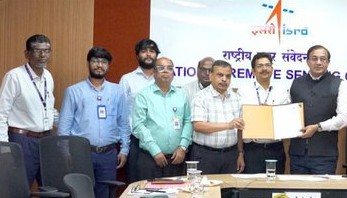
In a major step towards digital transformation and sustainable mining, Coal India Limited (CIL) has signed a landmark Memorandum of Understanding (MoU) with the National Remote Sensing Centre (NRSC), a premier centre of the Indian Space Research Organisation (ISRO), to develop an advanced satellite-based geospatial monitoring system on the BHUVAN platform.
The collaboration marks a significant milestone in the adoption of space technology for India’s coal sector and is expected to strengthen environmental governance, operational efficiency, and data-driven decision-making across Coal India’s mining operations.
The proposed geospatial dashboard, to be developed on ISRO’s BHUVAN platform, will provide comprehensive satellite-based monitoring of mining activities across Coal India’s operational areas. The system will facilitate real-time tracking of mining operations, afforestation and ecological restoration initiatives, Rehabilitation and Resettlement (R&R) programmes, land-use changes, and coal fire mapping, particularly in the fire-prone Jharia Coalfield.
The integration of high-resolution satellite imagery and geospatial analytics is expected to significantly enhance transparency in mining operations while enabling scientific monitoring of environmental compliance and land reclamation efforts.
The dashboard will also support Coal India in monitoring the progress of mine closure activities, evaluating plantation drives, assessing overburden management, and ensuring timely implementation of rehabilitation measures for project-affected families. Such data-driven monitoring is expected to improve planning, regulatory compliance, and overall governance in the country’s largest coal-producing company.
The initiative aligns with the Government of India’s vision of leveraging cutting-edge space technology for national development and reflects the growing convergence of digital innovation and natural resource management. It also complements the Ministry of Coal’s emphasis on technology-driven, transparent, and environmentally responsible mining practices.
The BHUVAN platform, developed by ISRO, has emerged as one of India’s most important geospatial platforms, providing satellite imagery, thematic mapping, and decision-support systems for various government departments and developmental programmes. The Coal India-NRSC collaboration will further expand the platform’s application in the mining sector by enabling near real-time monitoring and evidence-based policy implementation.
Industry experts believe that the partnership will set a new benchmark for technology-enabled mining management in India. By integrating satellite observations with operational data, Coal India will be able to monitor environmental performance more effectively, improve mine planning, detect unauthorized activities, and enhance the safety and sustainability of mining operations.
The initiative is also expected to strengthen monitoring of underground coal fires in the Jharia Coalfield, where scientific mapping and periodic assessment are crucial for planning mitigation measures and protecting nearby communities.
The collaboration underscores India’s growing focus on using advanced geospatial technologies to balance energy security with environmental stewardship. As Coal India continues to modernize its operations, the satellite-based dashboard is expected to become a key digital tool supporting sustainable mining, ecological restoration, and responsible resource management.
